FAQ
How does Geolist work?
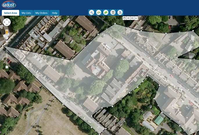
Geolist works on a postcode basis. We have a list of all the postcodes in the UK and we automatically place a hidden pin at the center of each postcode. When you draw a selection, Geolist determines which pins are located within the selected area and then returns the addresses assigned to each of those pins.
How do I know that Geolist provides accurate data?
All data supplied through Geolist has been verified against Royal Mail’s Postcode Address File (PAF). This ensures that the addresses provided can be delivered by Royal Mail.
Will I be charged for each selection I create?
No. You can create as many selections as you like. You will only be charged if you click the button and fill in the appropriate form to complete the checkout process.
Where are my maps saved?
Your maps are saved in My Lists and are kept indefinitely.
Can I share a map?
Yes. Maps can be shared with as many people as you like. Once a map has been shared, the recipient will receive an email with a link to their own copy of the map which they are then able to edit. Once they have finished editing the map you will be able to access the updated map. The updated map does not overwrite the map you originally drew.
Is there a way to automatically target all properties within a certain radius?
We have a tool on the Geolist website which will place an overlaying image with the radius specified. You will then be able to draw a selection which matches the overlay.
I drew my map several months ago but the mailing was delayed until now – how do I know that the counts are still up to date?
We regularly update the datasets used in the backend. If the map was drawn using an old dataset then Geolist will let you know this is the case. At the click of a button, Geolist will recalculate the data for the shape and provide you with updated counts.
Am I able to target businesses and not residential within a selection?
Yes, Geolist has the ability to target just commercial properties, just residential properties and both commercial & residential properties.
What are dataset layers?
Dataset layers are pre-drawn overlays we provide. They can be used to quickly and easily select areas such as wards, parish councils and cities.
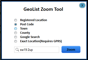
Am I limited to areas local to me?
No. You can select areas throughout the UK. When you log in the map will automatically focus on the address registered on your account. However, by using the search tool you can view all geographical areas in the UK.
Does my business have to be the centre of each geographical selection?
No. You can select anywhere in the UK. Your business does not have to be located within the selected area.
Can Geolist provide addresses from the rest of Europe?
Geolist currently only supports data from the UK, however we may implement this functionality at a later date.
Do you have a minimum quantity?
No, we are able to issue mailings of any size be they 1 record or 100,000 records!
Can I view the addresses before my mailing is issued?
We are unable to provide you with the full addresses unless you purchase a licence from ourselves; this is in accordance with Royal Mail’s terms and conditions.
However, we are able to provide a street listing report free of charge. This report lists all the streets within your selected area. The street listing report can be requested through the Geolist system.
Will I see the mail-outs before they are delivered?
Yes, once we have created your mail-outs they will be forwarded to your inbox to ensure you are happy with the final print. We will not proceed with the printing until you have confirmed you are satisfied with the mail-outs.
What if I am not happy with the standard of the mail-outs?
We understand that the mailing represents your brand and thus your satisfaction with the printed material is essential. If you have any concerns please contact us via email or phone and we will make the necessary adjustments.
How do I know the mail-outs have been delivered?
A full report is emailed to you showing you the full details of where the mailings have gone. A sample of this report can be seen here.
What is the time frame for the mail-outs to be delivered?
How urgent do you need to get the mailing out? Allow 3 to 4 days for the item to land but if you need it faster than that this can also be arranged.
A faster mailing depends on the number of items to be mailed out. If you need the mailing done within 24 hours we are usually able to accommodate this. The best way to find out if it’s feasible is to give us a call.
What control do I have over the artwork of the mail-outs?
You are fully in control. You can use our in-house design team or you can supply your own artwork to use.
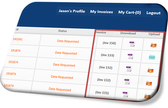
What happens after I order the data?
After you order the data one of our account managers will get in touch with you to obtain details of the mailing. This will include:
- The postage class
- Details of any artwork
- When the mailing needs to arrive by
How do I pay?
All payments are taken on a credit basis; we will ask you for a PO number once your account has been setup.
Can I change my delivery area selection once publishing has commenced?
Yes, this is no problem while publishing is taking place.
Is Geolist GDPR compliant?
Yes, Geolist is compliant with all aspects of the GDPR.
How can I use Geolist© for my clients?
Geolist's great asset is its flexibility. It can be useful for a wide selection of industries and non-commercial enterprise as an extra digital service for their own clients. The application can be embedded on your website under the branding of your company for a small license fee. To find out more contact us on +44 (0)1256 382065 Or fill in the contact form here.
Do I have to pay a licensing fee?
Yes and No, Depending on volume of business we will look at individual costs for licensing.
Introduction to Geolist
We have put together an introductory video providing a bried overview of the Geolist system. Please take a look!